
User manual · Chapter 11
Tracklogs
A tracklog records where you walked, using the phone's GPS, so photos from a camera without one can be placed afterwards. Everything about tracklogs is free.
Tracklog profiles
Make one with Actions → Add profile → I want to record my location as I walk around. A tracklog profile asks for nothing but a name: it has no devices and no photo storage, because a track isn't a file until you export one. It doesn't count towards the five profiles Free allows.
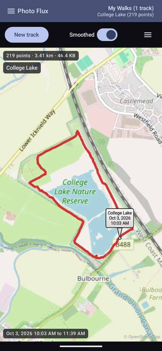
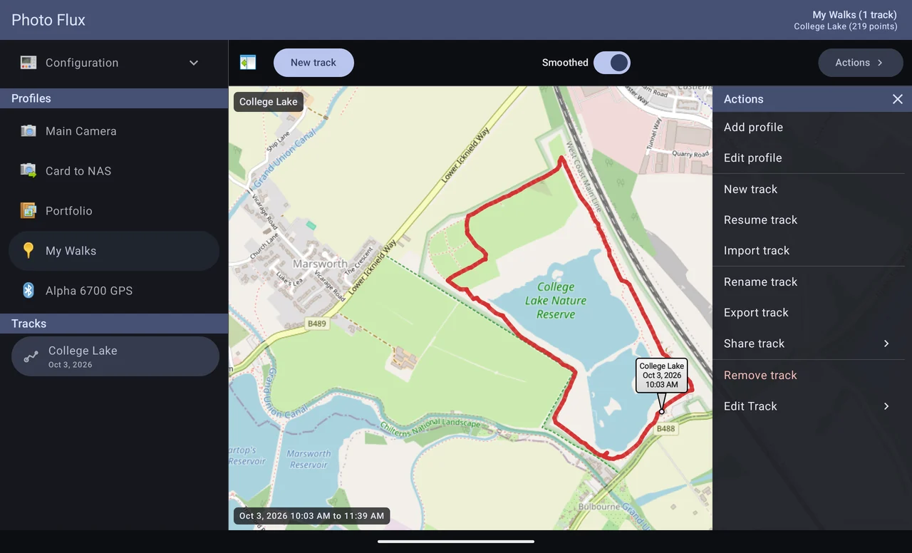
Select the profile in the drawer and it unfolds into its tracks; select a track and the gallery shows it, drawn over a map, with its point count, distance and size at the top and its start and end times at the bottom.


Recording
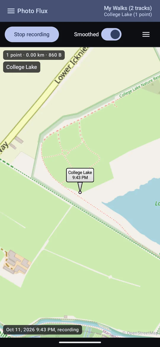
Tap New track. The first time, Android asks for location permission — the ordinary while using the app permission is all a tracklog needs, because recording is always started from inside Photo Flux. The button becomes Stop recording.
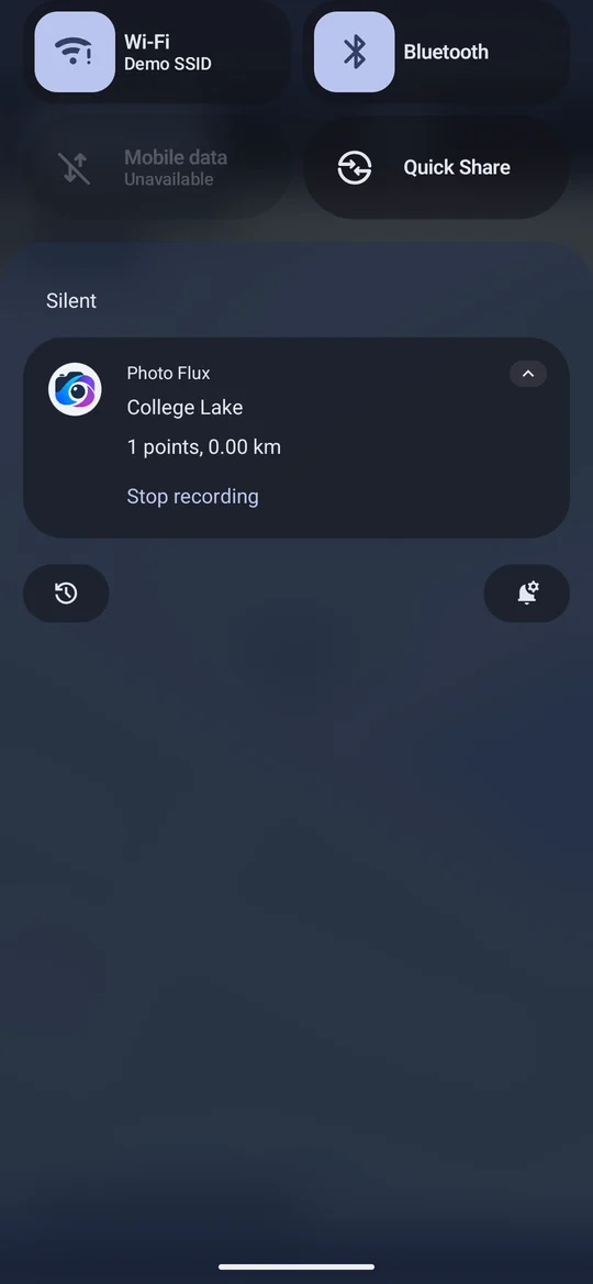
- It keeps going with the screen locked and the app in the background: an ongoing notification shows the track's name, points and distance, with a Stop recording button. There is no way to start a recording without opening Photo Flux.
- Only one track records at a time, whichever profile it belongs to.
- The name is made from the nearest place to where it started, using your own named locations first — College Lake. Rename it with Rename track.
- Resume track carries on recording into a finished track rather than starting a new one.
- It stops itself after half an hour without moving, so a track forgotten overnight doesn't drain the battery. You are told, and the track ends at its last real position rather than gaining a motionless half-hour.
- Losing the GPS fix is reported, and recording carries on: if nothing arrives for several minutes the notification says so and an alert is posted, and another when positions come back. Both can be switched off in the profile.
The recording interval
Set in the profile editor: how often the phone is asked for a position — from every second to every five minutes, default every ten seconds. That is what decides the battery cost. It is not what decides how many points a track has: points follow how far you actually go, about one every 15 metres. A change takes effect on the next recording.
Standing still
A GPS receiver standing still doesn't report one position — it reports a wandering cloud of them, and adding up the gaps once turned an hour on a desk into 5.5 km. Photo Flux decides while recording whether you are still or moving, and holds one position for as long as you are still:
- A stop is recorded as a point when you arrived and one when you left, with the time between — exactly what a photo taken during the stop needs.
- While still it marks the spot every couple of minutes, so you can see it's working. Those marks are all in one place, so they add nothing to the distance.
- It waits a moment before deciding: setting off takes a few fixes to be believed, and stopping about three quarters of a minute, so a pause at a kerb doesn't chop a walk in two.
- Fixes too vague to mean anything are dropped, and if most are, you are told — usually it means you are indoors.
- Distances read shorter than a naive GPS log, and more nearly right.
Smoothing
The Smoothed switch beside Actions steadies the line where the fix was poor, so a sit on a bench doesn't draw a scribble. The line redraws in place — flick it back and forth to see what changes.
- Positions are always saved exactly as received. Smoothing is applied when a track is drawn, shared or used to place photos, never to what's stored — so turning it off shows the raw trace, even for walks recorded long ago.
- It leans on the poor fixes and takes the good ones almost at face value, and it follows your speed: firm when standing, quick when driving. Minutes that went nowhere are placed at one spot.
- It errs towards leaving a track alone: a stop must be several minutes long, in one area, and have got nowhere. A walk out and back is never a stop.
- The distance shown is the distance of the line you can see.
- It isn't map-matching: Photo Flux doesn't know where the footpaths are, so a track is tidied, not snapped to a route.
- The switch starts from the profile's Smooth out GPS jitter setting, and your choice lasts until you switch profile.
Trimming a track
A recording usually starts before the walk and ends after it. Actions → Edit Track → Trim Start (or Trim End) takes the drive to the car park off the front, or the journey home off the back.

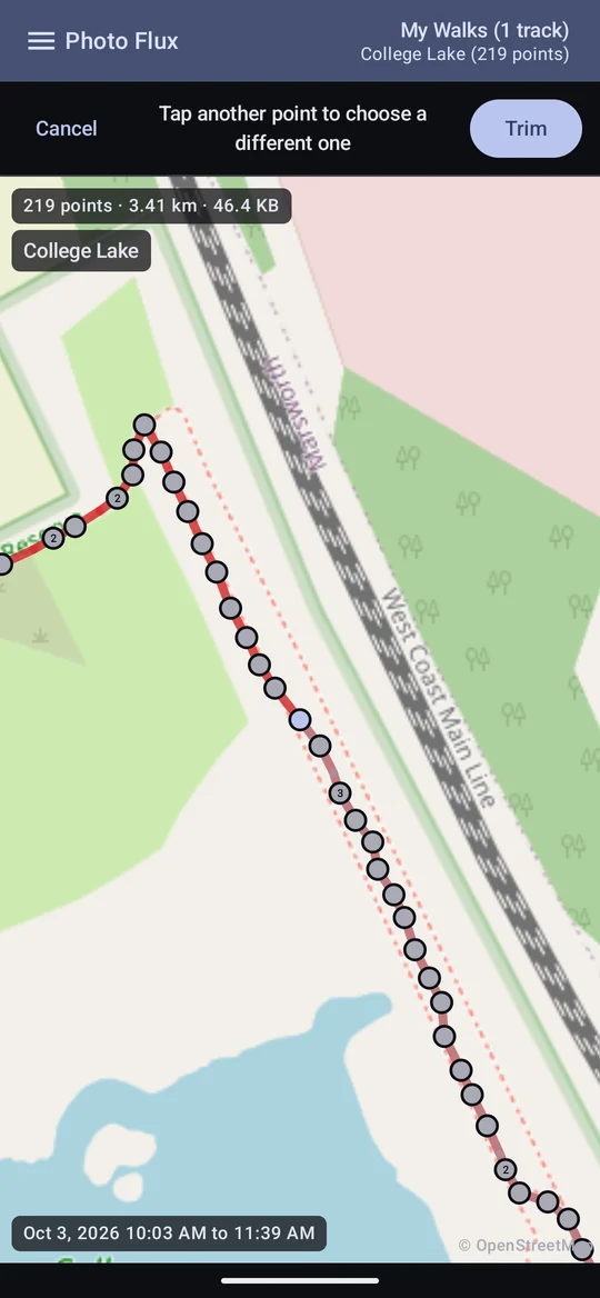
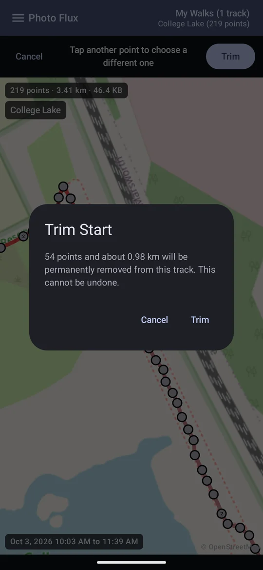
- Tap the point that should become the new start (or end) — the one that stays. Circles with a number stand for several points too close to tell apart; tap one to zoom in.
- The part that will go is drawn faded. Trim confirms with how many points and how far.
- It can't be undone: export the track to GPX first if you want the original.
- A track being recorded can't be trimmed, and a trim must leave at least two points.
- The distance and times follow the trim.
- Complete loop joins the end back to the start, for a walk that finished where it began but whose recording stopped a little short. It adds one point and no time, so it never changes where a photo is placed.
GPX files, merging and removing
- Export track saves a standard GPX file where you choose (it starts in
PhotoFlux/Tracks). The file is built fresh from what's been recorded, so a track still recording gives an honest snapshot — export again when it finishes. - Import track brings a GPX file in — from another app or device — as a track in this profile, ready for geotagging. A file holding several tracks, or a recording paused and restarted, comes in as one track with its parts kept apart, like a merged track's legs, so nothing is drawn or placed across the gaps between them.
- Long-press a track in the drawer to tick several: Actions then offers Export of them all, and Merge tracks, which makes them one track, ordered by time, and deletes the originals. A merged track's separate legs are never joined up when placing photos.
- Remove track deletes it and every position on it. Neither that nor deleting a tracklog profile touches any photo.
Sharing a track
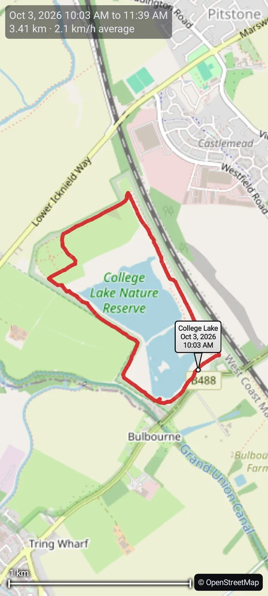
Share track offers Share GPX — the file, through the usual share sheet — and Share Map Image: the track and its pins drawn on an OpenStreetMap map the size of your screen, with the date and time, distance and average speed at the top and a scale in your distance unit, shared as a picture. With several tracks ticked, they are all drawn on one map.

Tracklog settings
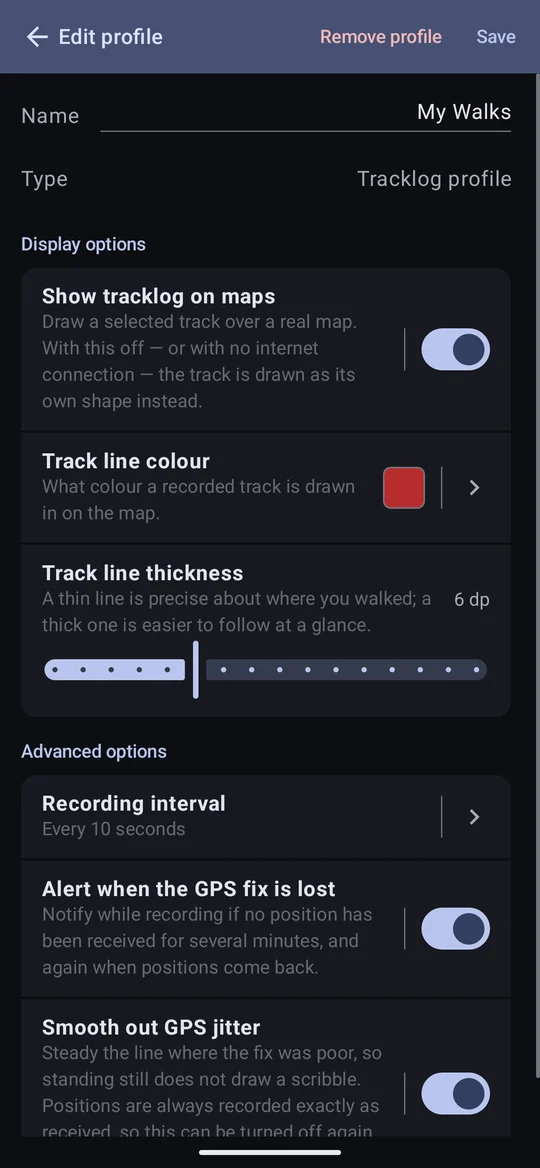
A tracklog profile's editor holds:
- Show tracklog on maps — draw tracks over a real map. Off, or with no connection, a track is drawn as its own shape on a plain background, with a scale bar and the names of places it passed.
- Track line colour and Track line thickness.
- Recording interval, Alert when the GPS fix is lost and Smooth out GPS jitter — described above.
A recording can also be started and stopped automatically by a GPS Provider as its camera connects and disconnects. Tracks from either source can place photos at import — see Geotag from tracklog.